A Submerged World Awaiting Discovery
Standing on the shoreline, we usually only spot crashing waves, passing ships, or the occasional distant island. Yet beneath that watery expanse lies Earth’s most immense and least understood terrain. The seafloor is anything but a flat stretch of sand, ranging from vibrant, sunlit shallows to pitch-black depths where light never reaches.
A Planet Dominated by Water
Water covers roughly 71 percent of our planet’s surface, with the oceans holding a staggering 97 percent of it. Because of this, the vast majority of the world’s mountains, sprawling valleys, and endless plains are actually submerged. Ironically, we currently possess more detailed maps of Mars and the Moon than we do of our own local seafloor.
The largest habitat on Earth sits in total darkness, miles below the surface.
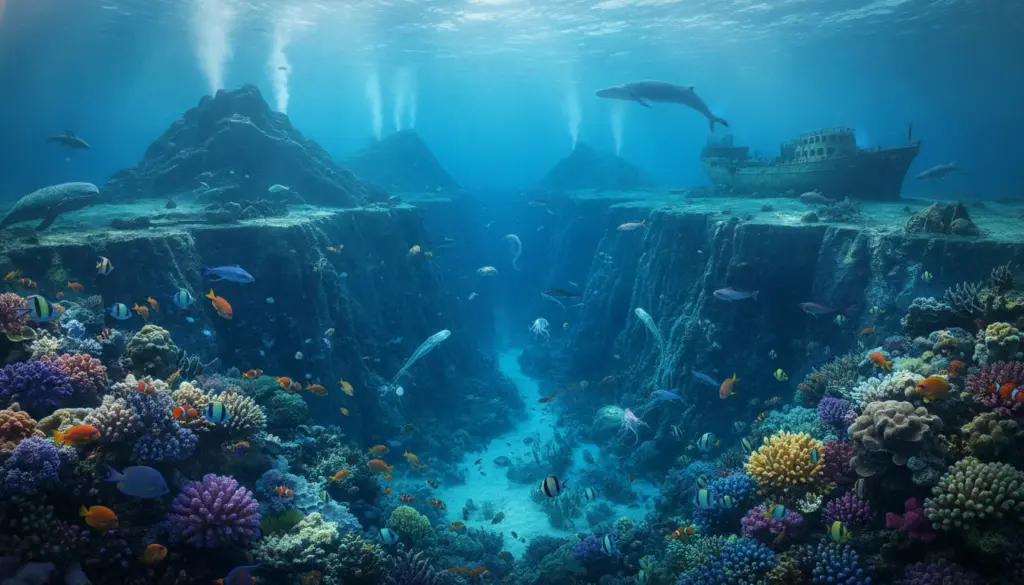
Through the use of advanced sonar, deep-sea submersibles, and satellite data, marine geologists are gradually piecing together the structure of this concealed world. Broadly speaking, the ocean floor is divided into distinct geological zones that shift dramatically as you move further away from the coastline.
The Continental Shelf: Vibrant and Sunlit
Heading straight out from the beach, you first encounter the continental shelf. Geologically, this shallow fringe is simply the flooded, extended edge of the continent itself.
- Average Depth: Usually dropping down to a few hundred meters.
- Total Coverage: Making up roughly 8 percent of the ocean floor.
- Light Levels: Sunlight easily penetrates here, allowing vital marine plant life to thrive.
While the actual width of this shelf varies drastically depending on where you are in the world, it is incredibly productive. Marine biologists estimate that about 90 percent of all marine fish reside in these specific waters. Nutrient-rich conditions and ample sunlight also mean that almost all seagrasses and a massive portion of the world’s algae grow in this bustling zone.
The Ancient Bridge Between Continents
The modern-day Bering Strait, bridging Alaska and Siberia, serves as a famous historical example of this shelf environment. Sea levels dropped by hundreds of meters during the last Ice Age, exposing this shallow shelf to create a massive land bridge. Researchers believe early humans utilized this exposed route to migrate from Asia into North America. Today, the sea has reclaimed the area, with its deepest sections plunging barely 55 meters down.
The Continental Slope: The Great Drop-Off
Once you reach the edge of the continental shelf, the terrain suddenly falls away at the continental slope. This transitional zone connects the shallow coastal edges to the extreme depths, making up about 9 percent of the global seabed.
The ocean floor generally tilts downward at an average angle of 4 degrees in this region. While that might sound gentle on paper, the depth plummets rapidly over a span of just a few dozen kilometers. Off certain coastlines, the seafloor plunges from a few hundred meters to several kilometers deep incredibly fast.
In specific geographic locations, this slope becomes exceptionally steep. Just southwest of Africa, far off the coast of the Cape of Good Hope, the seabed plummets an astonishing 6,000 meters over a mere 16-kilometer horizontal distance. That creates a staggering average incline of about 70 degrees, essentially forming a sheer underwater cliff face.
The Abyssal Plain: Earth’s Flattest Expanse
Beyond that steep drop lies a colossal, sweeping expanse known as the abyssal plain. Taking up roughly half of the entire seabed, these gently rolling or completely flat stretches sit at extreme depths between roughly 3,000 and 6,000 meters.
Compared to the dramatic continental slope, the abyssal plain is remarkably level. Instead of dropping thousands of meters in a short distance, the terrain here dips less than a single meter for every kilometer you travel. It represents the single largest continuous landscape on our planet.
Despite being our planet’s largest habitat by surface area, the abyssal plain remains completely foreign to us.
We know surprisingly little about this massive zone. Below 3,000 meters, complete and utter darkness reigns, making any kind of plant growth impossible. Any creatures surviving down here rely entirely on alternative food sources. They either consume organic debris drifting down from the sunlit layers above, or they harvest chemical energy clustered around blistering hydrothermal vents.
Abyssal Hills: The Bumpy Deep-Sea Terrain
However, the abyssal plain isn’t perfectly smooth everywhere you look. Vast sections are interrupted by abyssal hills—relatively modest underwater elevations jutting out of the flat terrain. Marine researchers estimate these features cover about 30 percent of the total seafloor.
Rising only a few hundred meters, these rocky hills are much smaller than true underwater mountains and never come close to breaking the ocean’s surface. They generally form through tectonic shifting or volcanic activity near mid-ocean ridges. For deep-sea wildlife, these bumpy landscapes provide vital hiding spots, influence local water currents, and occasionally trap floating food particles to create richer feeding grounds.
Seamounts: The Hidden Mountain Ranges
True underwater mountains, widely known as seamounts, are massive volcanic peaks that never managed to breach the water’s surface. Even though they can tower thousands of meters above the surrounding seabed, they remain completely concealed underwater.
These colossal structures generate swirling ocean currents around their rocky peaks. This continuous water movement pulls vital nutrients from the deep, attracting massive swarms of fish, deep-water corals, and other complex marine organisms. Consequently, seamounts act as vibrant biological oases hidden within the typically nutrient-poor open ocean. Since comprehensive maps of these peaks are rare, they frequently pose unexpected physical hazards to shipping vessels and commercial fishing gear.
Ocean Trenches: Plunging into the Abyss
Whenever giant tectonic plates collide and one is forced violently beneath another, they carve out narrow, incredibly deep chasms known as ocean trenches. These extreme zones represent the lowest points in the ocean and stand as some of the least explored environments on Earth.
The most famous geological example is the Mariana Trench in the western Pacific Ocean. Its deepest recorded section plunges roughly 11,034 meters below sea level. To put that staggering depth into perspective: if you dropped Mount Everest—the tallest peak on land at 8,848 meters—into the Mariana Trench, its summit would still be completely submerged under more than 1.5 kilometers of water.
The Earth’s surface plunges further below sea level than its highest mountains reach into the sky.
Pressures inside these trenches are absolutely crushing, frequently exceeding a thousand times the standard atmospheric pressure we experience on land. Yet, marine biologists consistently discover life here. Specially adapted microorganisms, tiny crustaceans, and specialized fish manage to thrive in these harsh realms of absolute darkness and immense hydrostatic pressure.
Volcanic Islands: When the Seafloor Breaks Through
When an underwater volcano erupts persistently enough over time, it can eventually pierce the ocean’s surface. At that exact moment, the seamount transforms into a true island. Iconic archipelagos like Hawaii were formed through this exact geological process, with restless volcanoes steadily growing upward out of the sea over millions of years.
You can actually watch this ancient planet-building process happen in real-time in places like Hawaii today. As fresh molten lava meets the cold ocean, it cools instantly into new rock, expanding the island’s coastline inch by inch. Simultaneously, crashing waves and rising sea levels slowly erode older volcanic islands, meaning they might sink back beneath the waves over vast stretches of geological time.
Counting the exact number of oceanic islands globally is surprisingly difficult. Expert estimates range anywhere from a few thousand to well over a hundred thousand, largely depending on how you technically define an island’s minimum size. Driven by shifting sea levels and ongoing volcanic activity, that global count fluctuates continuously.
Why the Hidden Seafloor Impacts Us All
Even if you never lay eyes on an abyssal plain or a deep-sea trench, these submerged geological formations directly influence global weather patterns, global seafood availability, and even modern communication networks.
- The continental shelf sustains a massive percentage of the world’s commercial fishing industry.
- Seamounts and steep slopes physically alter major ocean currents, which subsequently dictate global climate systems.
- Fracture zones and deep trenches are the primary birthplaces of massive ocean earthquakes and devastating tsunamis.
- Crucial infrastructure, like the massive telecommunication and internet cables connecting our continents, rests directly on the seabed, draped right over these rugged underwater terrains.
Because vast swaths of the ocean floor remain entirely uncharted, portions of our modern infrastructure rely on topographical knowledge that is still actively being gathered. Fresh deep-sea surveys constantly reveal that our current maps are either entirely outdated or missing massive geological features.
The Mysteries We Still Face
Countless mysteries remain locked in the depths. Scientists are still actively trying to determine exactly how many unique species inhabit the deep sea. We also don’t fully understand how these delicate benthic ecosystems will respond to ongoing ocean acidification and shifting global temperatures. Furthermore, the potential environmental impact of emerging industrial activities, such as deep-sea mining, poses serious regulatory questions for these fragile zones.
To find reliable answers, marine research teams are constructing more accurate maps using autonomous underwater drones and cutting-edge sonar technology. They regularly uncover forgotten riverbeds, hidden canyons, and entire mountain ranges in deep ocean areas previously assumed to be completely flat. These incredible discoveries provide geologists with fresh data on plate tectonics, help biologists track deep-water species migration, and show policymakers exactly which marine zones require urgent ecological protection.
Anyone attempting to uncover the ocean’s deepest secrets immediately hits intense logistical and technical walls. Launching manned or unmanned expeditions into the deepest trenches is both incredibly dangerous and financially draining. Yet, global interest is surging rapidly. This modern push isn’t just fueled by scientific curiosity, but also by the lucrative potential of rare minerals and valuable metals buried deeply in deep-sea sediments. Over the coming decades, this complex mix of conservation, scientific discovery, and economic ambition will only intensify the race to map our planet’s final hidden landscape.